Exploring Donau City’s landscape
10.04.2019
Urban space and research seen through the lens of the camera: Master students in geography and planning on their experiences with photography as a methodological tool for qualitative research. A summary by students and Sandra Guinand, researcher and lecturer at the Department of Geography and Regional Research.
What can we learn from Donau City’s urban space and design through photography? How can photographs be mobilized to bring out useful data and help feed research questions? These are the questions that Master students in geography and planning were trying to answer during the fall semester 2018/19, testing photography in situ as a mean to collect data. The Donau City is located in the north-east of central Vienna. It builds on two successive Masterplans: the original one from architects Krischanitz et Neumann (1995) and an updated version by Dominique Perrault (2001) which gave rise to the DC tower. Today, the area is still under construction. Students as well as strangers describe a strong feeling of disorientation – but how is this connected to the lived experience?
First impressions: “Disorientation” and “insecurity”
During a first session, students, without any prior information on the site, were asked to wander around Donau City, taking photographs that would be representative of their first impressions. These impressions would then be discussed in order to bring out the themes and research questions to be investigated during the course.
Donau City © Mark Scherner
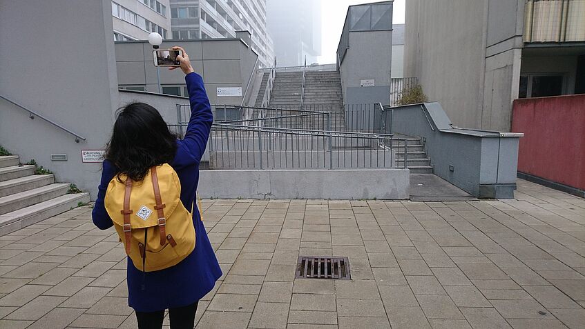
Anahi Montalvo about her experiences at the Donau City: “From an architectural point of view it has to be included in the design of the space the clues and the proper way to get to live the space. After wandering through the place, with no clue where I was going or how I should be getting to know the whole complex, the feeling of disorientation evolved into a non-wanted type of feeling”, writes the student.
While the Donau City was designed to contain and combine different uses, the public spaces are totally empty. Montalvo felt lonely and later insecure, she reported: “Even the playground for kids made me feel caged: the way they placed it in a lower level according to the street, gives you the impression of being trapped there, adding the few natural lighting that should characterize the open space and the high level of humidity made it an unpleasant space.”
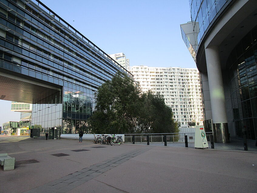
© Simon Volckaert
Also another student, Simon Volckeart, said, that the Donau City is barely used as a place to chill out: “The boulevard and square do not really fulfil the aspect of meeting people, although there were probably meant to be, as the bench on the left side of the picture suggests.”
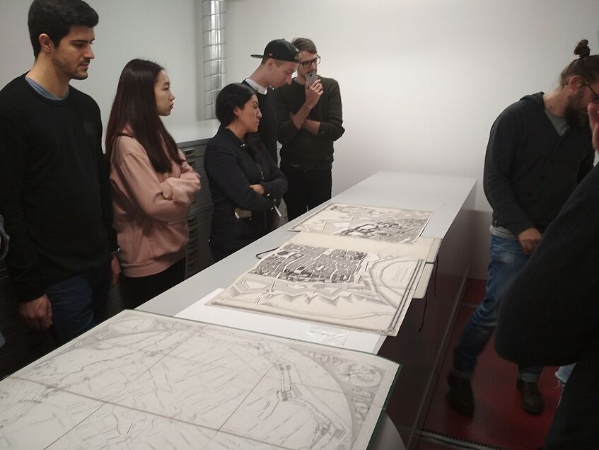
Photographic Archives
In the second session, students were acquainted with photographic archives. They visited the City and State’s Archives at the Gasometer, where Susanne Pils from the Archives explained the archiving process and how to look for material. After the tour, students looked for old photographs of Donau City from different sources trying to frame its past history as a mean to better understand its current situation, which brought new perspectives and “a better understanding of the surroundings”, as student M. Scherner put it.
© Viola Rossi
The following sessions introduced the students with different ways of using photography as a mean to gather information or shed light on a phenomenon. Students were asked to use photography either to document a specific place, make a series of a specific theme or bring the audience along a photographic ethnographic journey. While some students looked at notions of security and safety, other investigated the topic of orientation and disorientation in Donau City.
For instance, student Anahi Montalvo followed a stranger looking for his way through the Donau City (see picture below).
As a last step, students were asked to conduct photographic interviews. During this exercise, they selected two to five photographs from their previous work (documentation, series or ethnographic journey) that they showed to the interviewed persons. This helped them test their interpretation and analysis. Showing the interviewees relevant photographs helped building a communication bridge and winning information on how the person was feeling in certain areas under specific circumstances”, explained student Viola Rossi her experience.
“A twist to my geographical approach”
In general, the students stressed that the method was considered very useful: “Working with the method of photography gave a twist to my geographical approach”, commented Mark Scherner. “Combining photos with maps, counting and with historical data will enrich my geographical work in the future.”
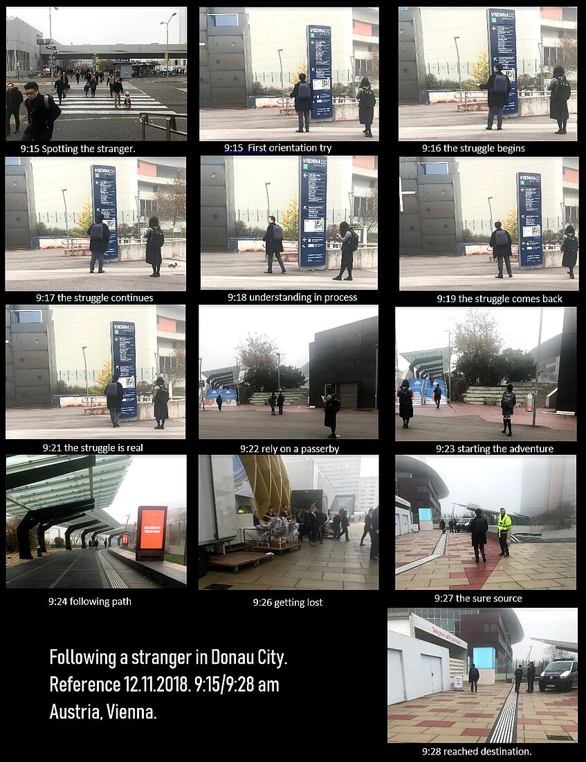
© Anahi Montalvo